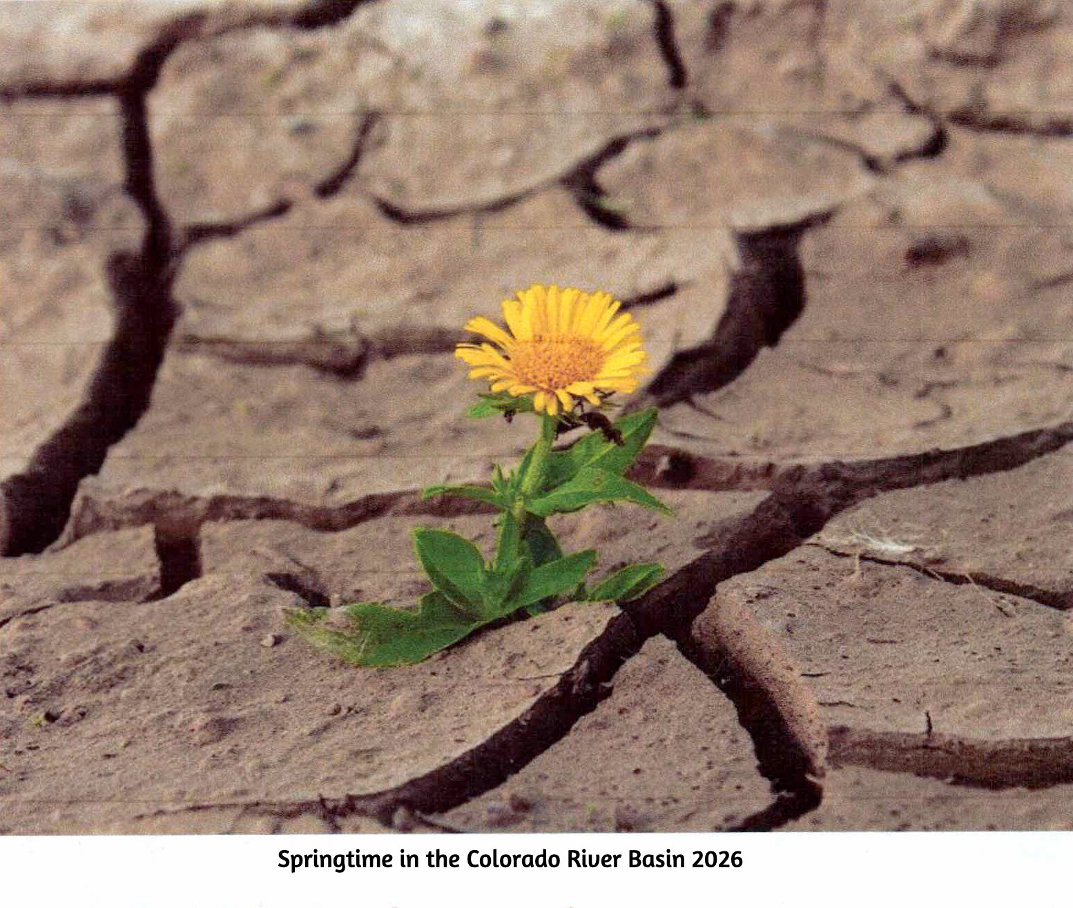
A bad year in the Colorado River Basin – barring a truly miraculous spring, probably the worst in recorded history. It is bad enough so the Bureau may have to stop creating power from the Glen Canyon powerplant by this coming fall. At that point, the only way to get water downriver from Glen Canyon Dam will be dribbling it through four outlet tubes that the Bureau is now wishing it had built differently (better) 65 years ago. And praying for enough precip to push the level back above the danger point for the turbines.
Meanwhile the negotiations between the seven basin states about the future distribution of the water remained at an impasse. One might think that a really bad year might generate some new thinking, but the two Basins are still debating Compact numbers like 7.5 million acre-feet for the Lower Basin with a river that might produce less than 5 maf this year, and maybe not much more than that more frequently in the future.
It should be obvious by now that any further negotiation between the states needs to have an independent facilitator guiding the discussion, pushing both factions to disassemble their own non-negotiables. A hard-ass facilitator speaking on behalf of river reality.
It seems likely that we will go into the 2027 water year this fall with some new ‘interim plan’ for operating the river system for the water year that begins in October – probably some mix-and-match from the Bureau’s five alternatives proposed last year and ‘EISed’ while the seven states fiddled. The real purpose of the new interim plan will be to keep the infrastructure of the river system viable – dancing with the dead pool. This will probably impose serious delivery shortages on those below the Powell and Mead Reservoirs (meaning the Lower Basin), and also drop the Upper Basin’s rolling 10-year total closer to the 75 million acre-feet (maf) that will cause the ‘compact call’ threat to rear its ugly head.
Year-to-year might be the most honest approach now, anyway, getting a habit of feeling our way forward carefully, with our eyes wide open – woke, one might say. The managerial ‘need for certainty’ in projections may not be part of the future we’ve imposed on ourselves.
But that’s a good place to let the present sit and settle, and go back to the unfolding saga of the ‘Era of Conquest’ in this update of Fred Dellenbaugh’s Romance of the Colorado River. You may remember that in the last post here, I related that the Bureau of Reclamation, feeling much loved for the Boulder Canyon Project that watered, fed and powered a massive regional development in Southern California, came out of World War II ready to do the same for the Compact’s Upper Basin, in response to a mandate in the Boulder Canyon Project Act that a plan be developed for the development of the rest of the river.
There was, however, already quite a lot of development going on in the Upper Basin – at least in the state of Colorado, beginning in the 1930s, simultaneous with the Boulder Canyon Project.
To establish context – the whole Colorado River Basin was experiencing its first serious modern-times drought, even as the Great Depression was settling over the whole nation. After the ‘pluvial’ of water abundance in the first three decades of the 20th century, which convinced the water mavens that the river would deliver a dependable-enough flow of nearly 18 maf, the basin experienced its first 5 maf flow in 1933; by the end of the 1930s, there was reason to doubt that the river would ever again average 18 maf.
But Colorado had a special problem to resolve about Colorado River water distribution: the transdivide situation. I will not bore you again with my opinion of the imperial arrogance in randomly laying down straight line state boundaries in a region of great geographic and geological diversity. But what this created in the irrelevant rectangle called Colorado was like a blanket laid over a fence – the fence being the Continental Divide. West of the Divide, precipitation that fell (mostly snow in the winter) all ran off toward the Pacific Ocean in the Colorado River tributaries. East of the Divide, it all ran off toward the Atlantic in the Platte, Arkansas and Rio Grande Rivers. Because the weather mostly rode in on the prevailing westerlies, considerably more precipitation fell on the West Slope than fell on the East Slope. But the vagaries of cultural and economic development put most of the population and economic growth on the East Slope – ‘80 percent-20 percent’ is the rough ratio frequently used to describe the imbalance between water and population in the blanket dropped over the fence.
The distribution of water on both sides of the ‘blanket’ was governed by the appropriation doctrine as stated in the Colorado Constitution: all the water in the state belongs to the people of the state, subject to appropriation for individual use, and the right to divert ‘shall never be denied’ – with seniority among users determining the right to use the water in times of shortage. And by the turn of the century, challenges in water court had established the right to divert water from one basin to another.
As the drought of the 1930s settled in, farmers on the East Slope began to experience serious pressures on the water supply. And consistent with the optimism and technological advances of the early 20th century, this was not regarded as a fact of life to be acknowledged and adapted to, but as a problem to be addressed – in this situation, by moving water from the West Slope. A major task – but Franklin Roosevelt’s ‘New Deal’ efforts to alleviate the Great Depression offered the possibility of some help, through new agencies like the Reconstruction Finance Corporation and the Public Works Administration.
So when the Colorado General Assembly gathered early in 1933, two water project bills were in the hopper: one to divert an unspecified quantity from the Upper Colorado River in the Grand Lake area to the South Platte River basin, and one to divert an unspecified quantity from the Gunnison River to the Arkansas River basin.
Inhabitants of the West Slope, however, knew nothing about this until they read about it in the newspapers. And they were even more surprised that summer when construction actually began on two transdivide projects: the Denver Water Board began constructing a system of small canals high in the Fraser River headwaters (Upper Colorado tributary) to bring water to the Moffat railroad tunnel pilot bore, which the Water Board had leased from the railroad – an unused but already dug ‘pipe’ to the northern Denver area. And the sugar-beet industry led by Great Western Sugar was doing the same collection system in the headwaters of the Roaring Fork River above Aspen for diversion into a small tunnel to the Arkansas River basin. Both of those enterprises were self-funded.
All of this precipitated a regional West Slope meeting in Grand Junction of ‘water people’ – county commissioners and attorneys who were also all ranchers or farmers – at which a ‘Western Colorado Protective Association’ (WCPA) was formed, and a letter was drafted to the state engineer expressing concern that the proposed and in-process projects threatened the future development of the West Slope, and requesting inclusion in all future discussion of them.
The situation as the West Slope people saw it was not a ‘water grab.’ The leadership in the WCPA knew that the East Slope irrigators and city-builders were exercising a constitutional right in appropriating ‘the people’s water’ on the West Slope. They also knew that most of the Colorado River water left the state’s West Slope in an unmanageable snowmelt flood anyway, and it might as well go through a tunnel to the Front Range as through Grand Junction and on to – well, soon, on to enviable storage behind the great dam being built far downstream rather than its historical destiny of flowing on into the salty sea unused.
Storage! That was the key to the West Slope’s chief water problem, which was water available throughout the growing season for finishing as well as starting crops. West Slope engineers had been drafting up a number of reservoir-and-irrigation projects to present to the Bureau of Reclamation, but dams are expensive, and all of the proposed reservoirs served mountain-valley populations too small to pass the Bureau’s cost-benefit analyses.
So the concept of ‘compensatory storage’ for water lost through transdivide diversions became the WCPA’s central focus. And despite their small population, the WCPA had two good cards to play. One was the fact that New Deal federal funding distributed to the states had to be for projects approved by the entire state; the transdivide diversions that needed federal assistance needed for the basin of origin to be as happy as the basin of destination.
The other card was a congressional representative, Edward Taylor, whom they had returned to Congress for 12 terms by 1933, and who had over that quarter-century ascended to chairmanship of the subcommittee that controlled the Interior Department budget in the powerful House Appropriation Committee. Congressman Taylor launched the WCPA’s ‘defensive offensive’ by saying that any project seeking federal assistance for a transdivide diversion would have to provide, as part of their project, an acre-foot of compensatory storage for the West Slope for every acre-foot to be diverted.
That was a large and very expensive demand. Taylor exempted Denver and its Moffat project from the mandate – because, he said, we all want to see ‘our capital city’ grow unrestricted. More likely, he knew that Denver could fund its own project and would at best just ignore him; he was not their congressman, and the Denver Water Board at that point was coming under the domination by their attorney, Glenn Saunders, a city-builder who envisioned a water supply for a ‘thousand-year city,’ most of which he thought would have to come from the West Slope. He just wanted the hicks to stay out of his way. (Not an exaggeration at all.)
Taylor could, however, impose his acre-foot-for-every-acre-foot demand on those seeking federal Public Works Administration funds or Bureau of Reclamation assistance. And that set up what is really an interesting story of people working out difficult problems they’ve imposed on themselves in draping a blanket over a fence and calling it a state, then adopting a wide-open appropriations doctrine for the distribution of a limited resource statewide. It’s a story with many moving parts that we don’t really have time for here in depth; I will note, however, that the whole story is told in my Water Wranglers book, the story of the development of Colorado’s share of the Colorado River. (Out of print, but copies supposedly in all Colorado libraries.)
The principal players in the story were the Western Colorado Protective Association (WCPA), led by Frank Delaney, a lawyer-rancher, and D.W. Aupperle, a Grand Junction lawyer and fruit grower; the South Platte Water Users Association (SPWUA), led by Charles Hansen, a newspaper editor in farm country and a couple lawyer-farmers; and of course the Bureau which wanted to do a big transdivide diversion to the South Platte River. And what turned out to be the ‘wild card,’ Congressman Taylor.
A seemingly endless series of meetings began between the WCPA and the SPWUA with the Bureau in attendance. There was fundamental agreement that, first, the East Slope had legal right to appropriate West Slope water, and second, that the East Slope owed the West Slope some compensation for diverting part of the West Slope’s base for future development. The challenge was arriving at the amount of compensation. The SPWUA wanted to divert more than 300,000 acre-feet from the Colorado River, for what became the Colorado-Big Thompson Project, but they did not see how (even if they could get some New Deal PWA financing) they could afford to also create that much West Slope storage. But the WCPA felt bound to support their congressman – without whom they really had no card to keep them in the game. Frustration and ire grew on both sides – compounded by having to travel back and forth either on the slow trains or drive on roads that were really ‘country’ (a major West Slope chronic complaint).
Finally, in the spring of 1936, Frank Delaney of the WCPA suggested a compromise. If the Bureau and SPWUA wanted to rush into construction, it would have to be Taylor’s acre-foot-for-an-acre-foot mandate. But if they could delay their project until the Bureau did a thorough study of what the loss of 300,000 af of free-flowing water (most of it annually leaving the state unused anyway) would be to the West Slope, and how much storage would actually compensate the West Slope users for that loss of spring runoff, the West Slope would accept that number (and work on getting Cong. Taylor to accept it).
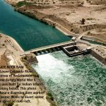
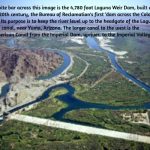
The ‘Delaney Resolution’ broke the stalemate. The Bureau men spent months poring over existing rights and land maps (long before computers and spreadsheets), and came up with a need for 152,000 acre-feet of compensatory storage: 52,000 af to make sure that the Shoshone power plant water right above Glenwood Springs could be met year round (which would also ensure enough late season water for the Grand Valley farms and orchards), and 100,000 af for future irrigation and domestic water development.
That cut Taylor’s demand in two – and the Bureau planned to add a powerplant to the dam that would significantly reduce what the SPWUA would have to pay back. During this period, Taylor – an old man – was actually too sick to participate, and the Delaney Resolution was adopted for the Colorado-Big Thompson Project. (Taylor would die in office in 1941 – still believing that an acre-foot-for-every-acre-foot was what should be adhered to.)
The compromise process was codified as ‘Senate Document 80,’ part of the Colorado-Big Thompson Project Act passed in 1937. Senate Doc. 80 became part of all subsequent transdivide project planning – except where Denver was concerned; it wasn’t until the veto of Denver Water’s Two Forks Project half a century later that Denver Water finally conceded to take West Slope needs into account in its transdivide projects.
That process of working through a significant challenge to mutual benefit stands, in at least my mind, as one of the highlights of the Era of Conquest in the Colorado River region – a period not without occasional efforts measuring up to the often naive but high-minded vision driving the developers’ ‘romancing of the river’ – to bring deserts into bloom, to reshape unfriendly environments to accommodate individuals and their families willing to work at it. It is too easy to condemn that from this side where we reap the harvest of all the mistakes involved that they didn’t know about until they had made them.
Next post, we’ll look at what happened to that carefully forged intrastate resolution when serious Colorado River planning came to the Compact’s Upper Basin. Meanwhile – pray for monsoons, or just a good rainy spell.
***
Leave a Reply
Recent Posts
- Advertisement for My Self + Romancing the River – Elephants in the River
 This is the cover of a new book I’ve just published, Storm in My Head, a collection of poetry written over the 60 years I’ve been living in the headwaters of the Colorado River, since 1966. My 60-year celebration. Those of you who prefer your literature in sprints and strolls over the marathon essays I ... Read More
 - Romancing the River: The Era of Conquest 3
 A bad year in the Colorado River Basin – barring a truly miraculous spring, probably the worst in recorded history. It is bad enough so the Bureau may have to stop creating power from the Glen Canyon powerplant by this coming fall. At that point, the only way to get water downriver from Glen Canyon ... Read More
 - Romancing the River: The Era of Conquest Part 2
 The hard news about the Colorado River since my last post here is not good; we had a storm that dropped around two feet of snow above the 8,000-foot elevation – well, maybe the 9,000-foot elevation. But that was followed by a couple weeks of ridiculously warm weather for February and early March, with more ... Read More
 - Romancing the River – The Romance of Conquest, Part 1
 We’re an empire now, and when we act, we create our own reality. – Senior advisor to Pres. G. W. Bush, 2004 You’ve seen that quote here before – and you’ll probably see it again; if this were a Wagnerian opera, that line would be a lietmotif, a recurring musical thread associated with a particular ... Read More
George: Thoughtful and thought-provoking installment as usual! A question: What is meant by: “the danger point for the turbines”?
I’ve been inside the turbine “room” a couple of times at Glen Canyon dam. As it was explained to me, if there’s water they spin, if there isn’t they don’t. No mention was made of them being “in danger” if they don’t spin.
Thanks!
Thanks for catching that, Mike – a sentence of explanation is needed. Water on or near the surface of a reservoir still has quite a bit of air in it that has been compressed out of the water deeper down by the weight of the water above. The air in the water flowing fast down through the power-generating turbines will cause cavitation – water pounding at a microscopic level against the pipes and turbine blades rather flowing through them smoothly. The same force that broke up the Glen Canyon spillway back in 1983 and threatened the integrity of the dam. So the Bureau does not want to use the top ten feet or so of the reservoir’s water for power generation for that reason. Things we learn through experience that we hoped would never come back to bite us, but now are.
Lordy, what a history–an all-too-human one–of short-sightedness (yes: Monday morning quarterbacking) and stubbornness, and what’s-the-hurry?-ness. In the end, “progress” wins out. I know: Let’s just keep kicking the can down the ol’ road.
‘Monday morning quarterbacking’ by the coaches makes next Sunday’s game better; it’s called postgame analysis. When it’s done by the rest of us, it’s still analysis, critical thinking, even if no one is listening. Worth doing.
I hesitate, or pretend to hesitate, to say anything at all here because I am certain I don’t comprehend the vast complexity of divvying up a fair use of water among an equally vast number of people. But from where I come we used to think that if a solution to a problem didn’t work then we had not figured out the correct “why” there is a problem. To my feeble minded sense of things it seems like there just ain’t enough river to go around. I think John Wesley Powel said that back in 1876 or something.
If that is the case, that there just ain’t enough river to go around, then it would seem smart to me to abandon all the wasted effort trying to make it be enough. It seems to me other solutions might ought to get some attention.
I would be the first to admit that killing off 95% of the present day consumer population is not a good idea. So, in my feeble mind it seems that we need to find other sources of water. Maybe extract the salt out of ocean water. Maybe pipeline water from places in the country where water is always plentiful. And here is why I pretended to hesitate to write this. I don’t have a clue how we would go about desalination or piping in water. But I know there are minds out there that could figure it out. I bet anything we would do along those lines would be expensive as hell. But our Federal Government never has a problem coming up with enough money to blow other countries to smitherines, so it could probably come up with the money to fix this little water problem.
But what do I know? Not very damn much, I can promise you that. I’m just an artist in the sunset years of his life.
You’re right enough, Denny, in that lots of people are working on both the desalination of ocean water, which is happening in San Diego and will be happening elsewhere along the coast – and on the idea of piping water from the Mississippi or lower Missouri. You are also right in that it would be very expensive to do so. There’s the further fact that the Mississippi is experiencing shortages in having enough water to float the major barge traffic… And routing a big pipe through several other states that would probably all also want a cut of the water would be a legal situation almost beyond imagining. Don’t hold your breath on that one!
A hard copy of Water Wranglers is available on Amazon and an e-nook comes from Barnes and Noble. A copy apparently sold on ebay for $129.
It is almost impossible to believe that the states are clinging to numbers that have always been wrong and potentially destroying a culture more effectively than our president could ever dream. We really are in a world of ‘alternate’ facts.
Thank you. Great summary and explanation of the East Slope versus West Slope interests and compromises that set the stage for water usage and development in Colorado during the 20’s and 30’s including the back story of the important Colorado-Big Thompson Project.
George, great work as always. Perhaps this millennium drought will finally make the parties realize that we have a problem that won’t be solved by posturing and legal threats. I’ve long wondered at what point we begin to work toward real solutions: Will reaching “dead pool” be enough? Ten dollars for an avocado? One hundred dollars for a pound of almonds?
As a medium term solution I foresee two massive desalination projects, both located in Mexico, one south of Tijuana and one somewhere west of Puerto Penasco. This would meet the lower basins’ water needs but it wouldn’t replace the power generation loss if the river was all used up in the upper basin. I recently read a paper by a group of optimistic scientists about small reactor fusion development on the horizon. They believe it could drive our cost of energy to near zero, and allow us to make water in the reaction. I take comfort in my faith in mankind’s ingenuity as I pray for rain.
Thanks, Hans – Desalination will be part of the solution for the big urban concentrations, but unless we do get energy at near-zero cost, I doubt it will ever be able to replace surface+groundwater for irrigation; despite improvements it is still pretty expensive water…. I share your faith in mankind’s ingenuity, but in the meantime I will continue to pray for rain.